Tuesday,
April 18
Today
marked the end of digging for the two panel holes (#’s 18 and 19) for the “Tombigbee
River” panel. Natalie removed exactly 12 inches of clay before she found the
chalk bedrock. That exactly one foot of clay in this area seems to strengthen
our hypothesis that it was brought up to the cliff as part of a well
thought-out plan to stop erosion and raise the level of the ground surface. 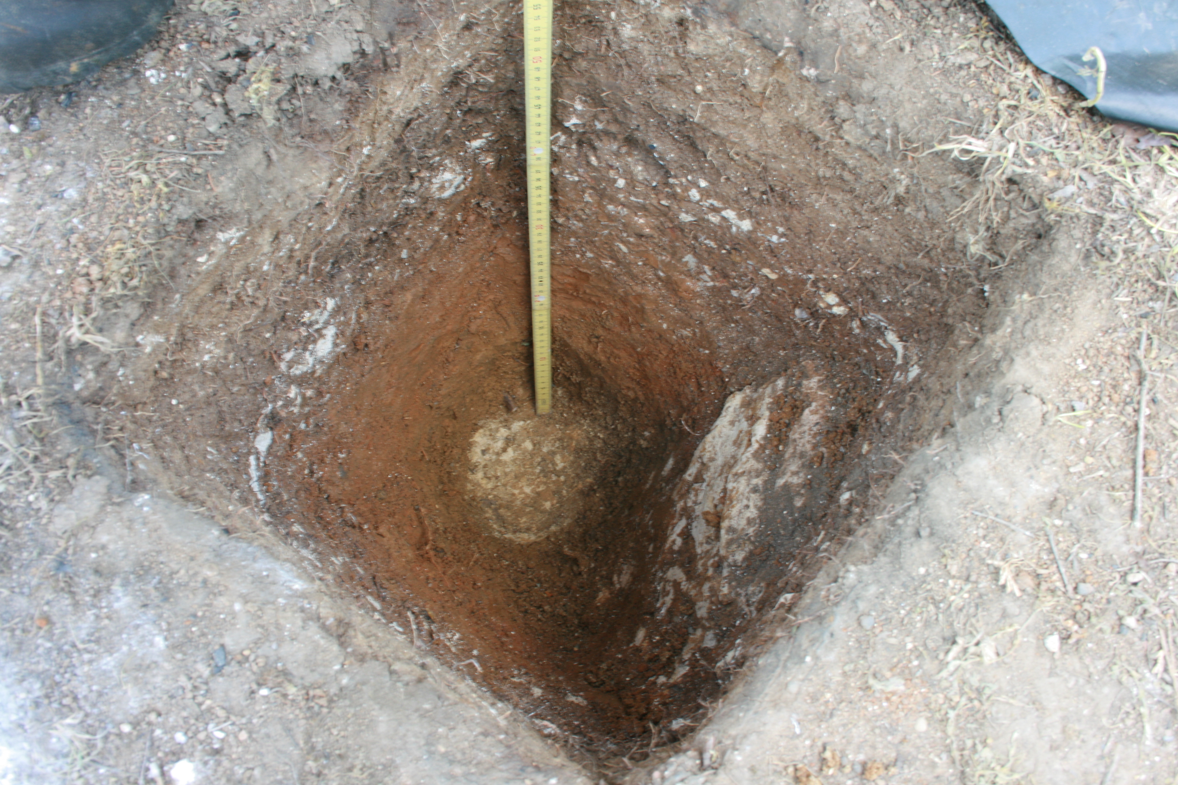 We
drew profile walls for each of these two panel holes to record the different
levels and time periods that we dug through, as well showing the modern post
hole found in my panel hole (see previous blog post). After finishing these
holes, we moved back to the panel holes that we had been excavating for the “Life
in a Frontier Fort” panel but which were shut down because of all the rain. This
panel is in the area that was between the Spanish oven and the officer’s
quarters. In panel hole #14, we found another fragment of an iron strap in the
southwest corner. It has tiny rivets in it, but we’re not sure what it is. It
seems too thick to have been the iron strap around a barrel, so maybe it’s part
of a tool.
We
drew profile walls for each of these two panel holes to record the different
levels and time periods that we dug through, as well showing the modern post
hole found in my panel hole (see previous blog post). After finishing these
holes, we moved back to the panel holes that we had been excavating for the “Life
in a Frontier Fort” panel but which were shut down because of all the rain. This
panel is in the area that was between the Spanish oven and the officer’s
quarters. In panel hole #14, we found another fragment of an iron strap in the
southwest corner. It has tiny rivets in it, but we’re not sure what it is. It
seems too thick to have been the iron strap around a barrel, so maybe it’s part
of a tool.
Meanwhile,
Valencia and Cory have begun excavating panel holes #15 and 16 for the “Native
American” panel that will be installed. These holes are only about 15 feet from
where Natalie and I are working now, but they are in an area that would have
been just a few feet from the wall of where the Spanish and French officer’s
quarters were located. It will be interesting to see what sorts of artifacts
are found here. So far, Valencia and Cory are finding a lot of gravel in Layer
A, and it most likely came from the roadway that was put through here when
there used to be a campground nearby.
Thursday,
April 20
Today
we continued the panel holes for the “Life in a Frontier Fort” panel. After
some cleaning up of Layer B, we hit what we believe to be bedrock only about 25
to 30 cm beneath the ground’s surface. In other holes we have seen thick layers
of chalk and clay interchanging to more than 50 cm deep. It just doesn’t show
up here, so there must not have been a need to fill in the land in this area.
Most of what we removed from these two holes seems to be loose debris and some
chalk rubble. At the holes for the “Native Americans” panel, hole #’s 15 and
16, we began excavating Layer B, but no artifacts were found. No deeper than
10-12 cm below the surface, we hit big pieces of chalk. In the right side panel
we were still in Layer A, so not much was found.
Friday,
April 21
Today
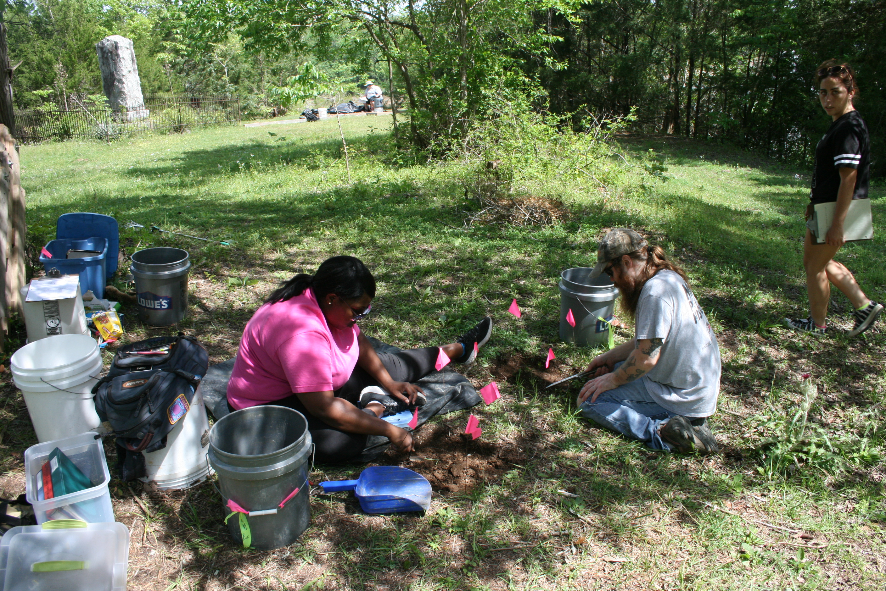
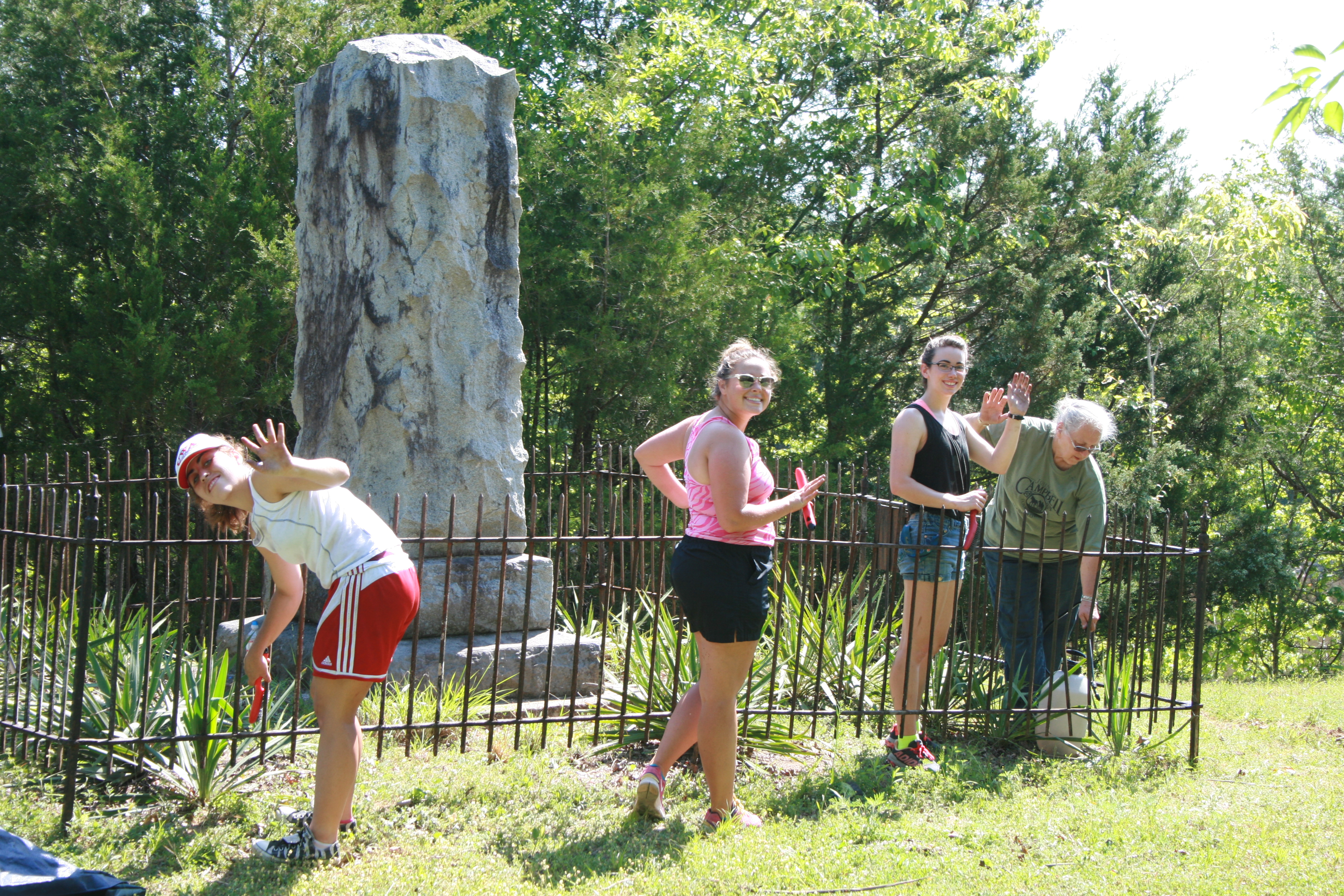
we had a volunteer and clean-up day out at the fort. We would like to thank
everyone that came out to help clean up the fort, including Mrs. Rosa Hall,
Steven Meredith, James Lamb, Tim Truelove, Jessica Smyth, Daniel Rhodes, and Connor
Kendrick and Tyler Sessions of Delta Chi. The last two were recruited by UWA
alum and fort supporter Jay Lindsey.
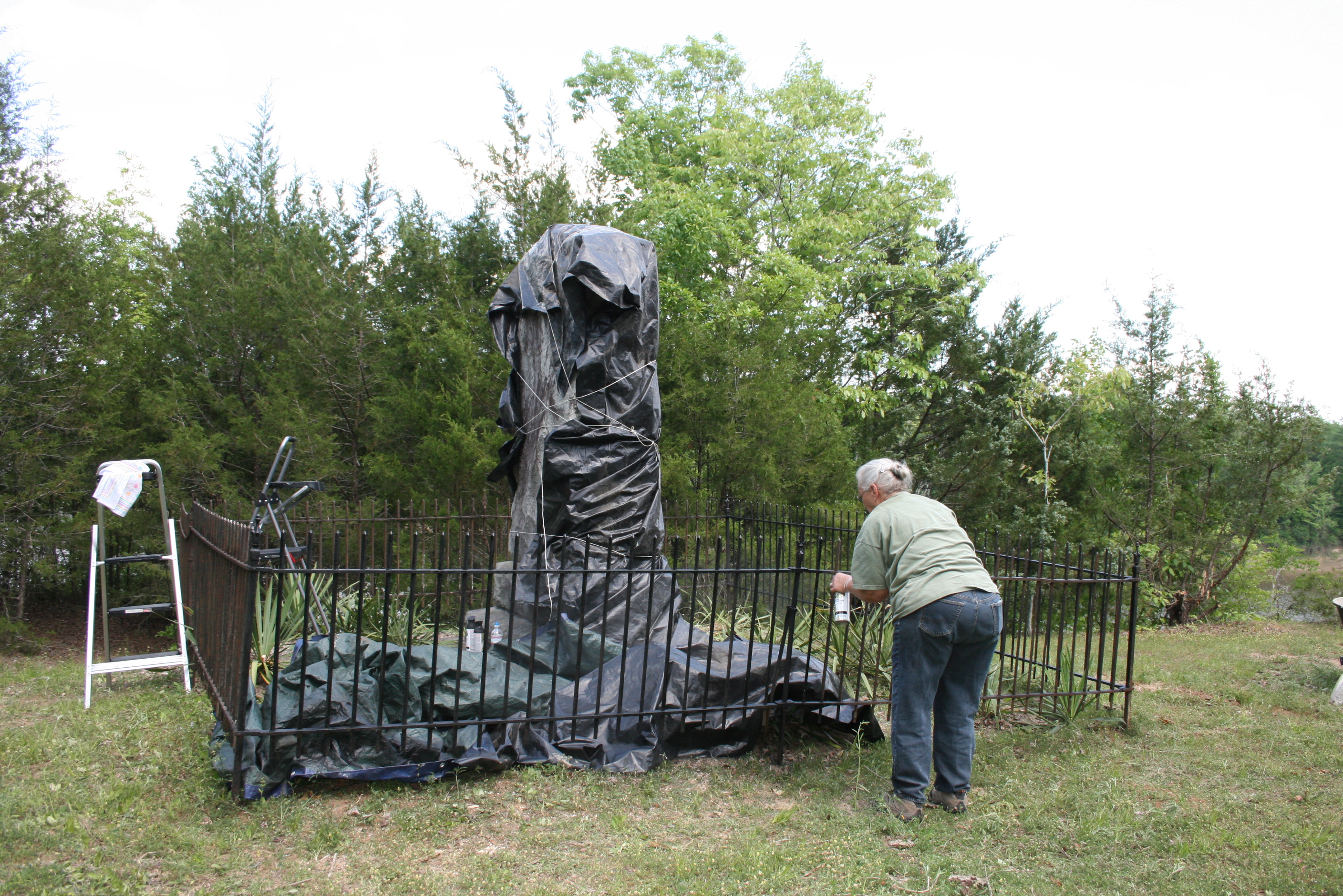
Rosa led several volunteers in scrubbing
and painting the iron fence that is around the granite monument. The fence has
a plaque that reminds visitors that students from the History Department of the
Alabama Normal College (now UWA) donated the fence. The monument itself was
erected by the National Society of the Colonial Dames of America in 1915. Its
antiquated text is a reminder of how important history and archaeology are for
correcting our perspectives on the past. The text reads, in part: “Where
civilization and savagery met and the wilderness beheld the glory of France.”
While
this was going on, we were able to get the right side of panel hole number 13
cleaned up for a photo. We also started hitting bedrock on the left side of the
“Life” panel, but were not able to finish it before we left for the day. In the
“Native Americans” panel holes, we continued on #16. We started to dig it out
with a shovel to try and finish the hole because by this time we had not seen
anything significant. After some digging, we noticed a change in clay color on
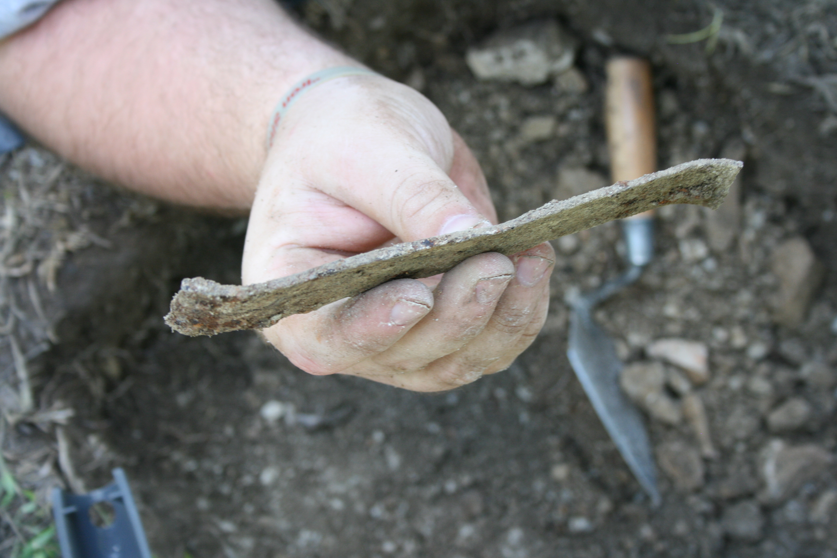
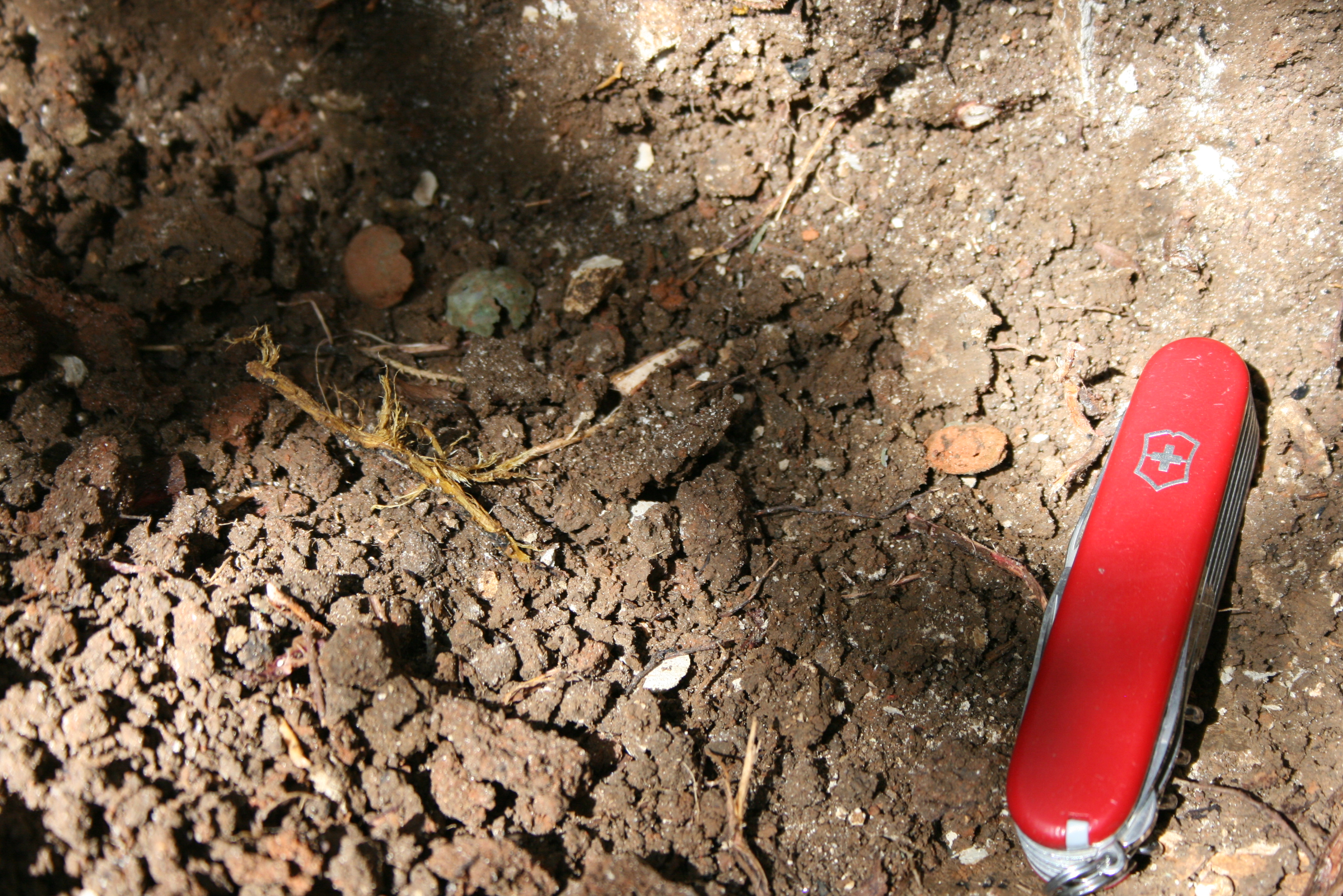
the East side of the hole. Additionally, we noticed that we were pulling up big
pieces of glass, a button, a clasp, and other artifacts, so we went back to
using trowels and going at it slowly. We have encountered some sort of feature,
perhaps a trash pit, which is full of artifacts. The pieces of olive green wine
bottle are shaped like those dating to the latter half of the 18th
century, so we suspect that this pit is full of Spanish-period artifacts. We
won’t know for sure until all the dirt is screened, washed at the lab and
carefully sorted. Unfortunately, the pit extends beyond the borders of this
panel hole, so future students will have to finish excavating it. Look carefully in the photo below, and you'll see three layers of a brass button that came apart as it was excavated.
For the “Native Americans” panel, hole
#13, we used an iron pick ax to break through the chalk, which turns out to
have been more rubble and clay intentionally placed as fill. It was deposited
directly on top of the chalk bedrock.
Saturday,
April 22
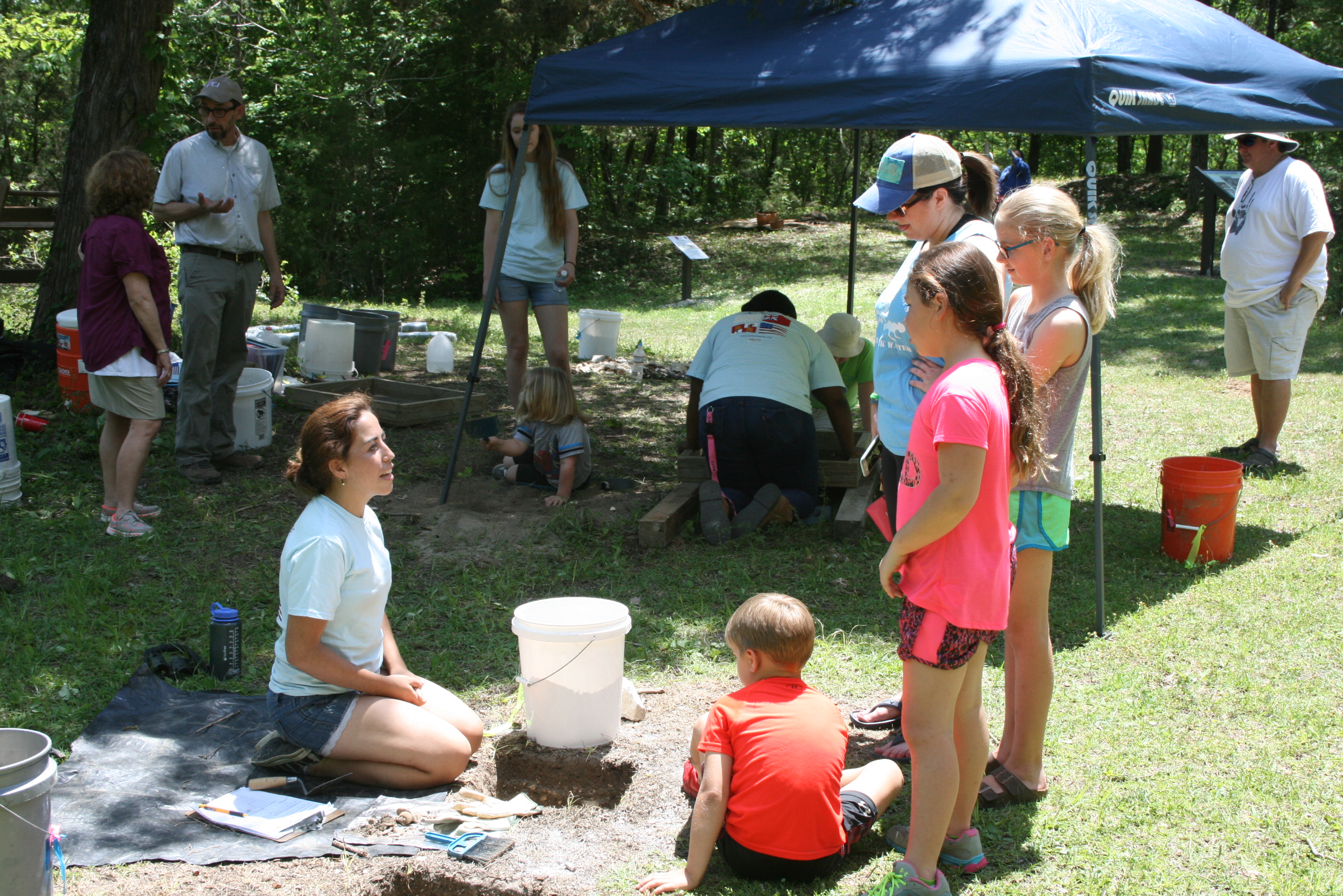
Today
was Community Day. We would like to thank everybody that came out, along with
the helpers that came out to make the day a success. Officially, we had 87
people come out and visit!
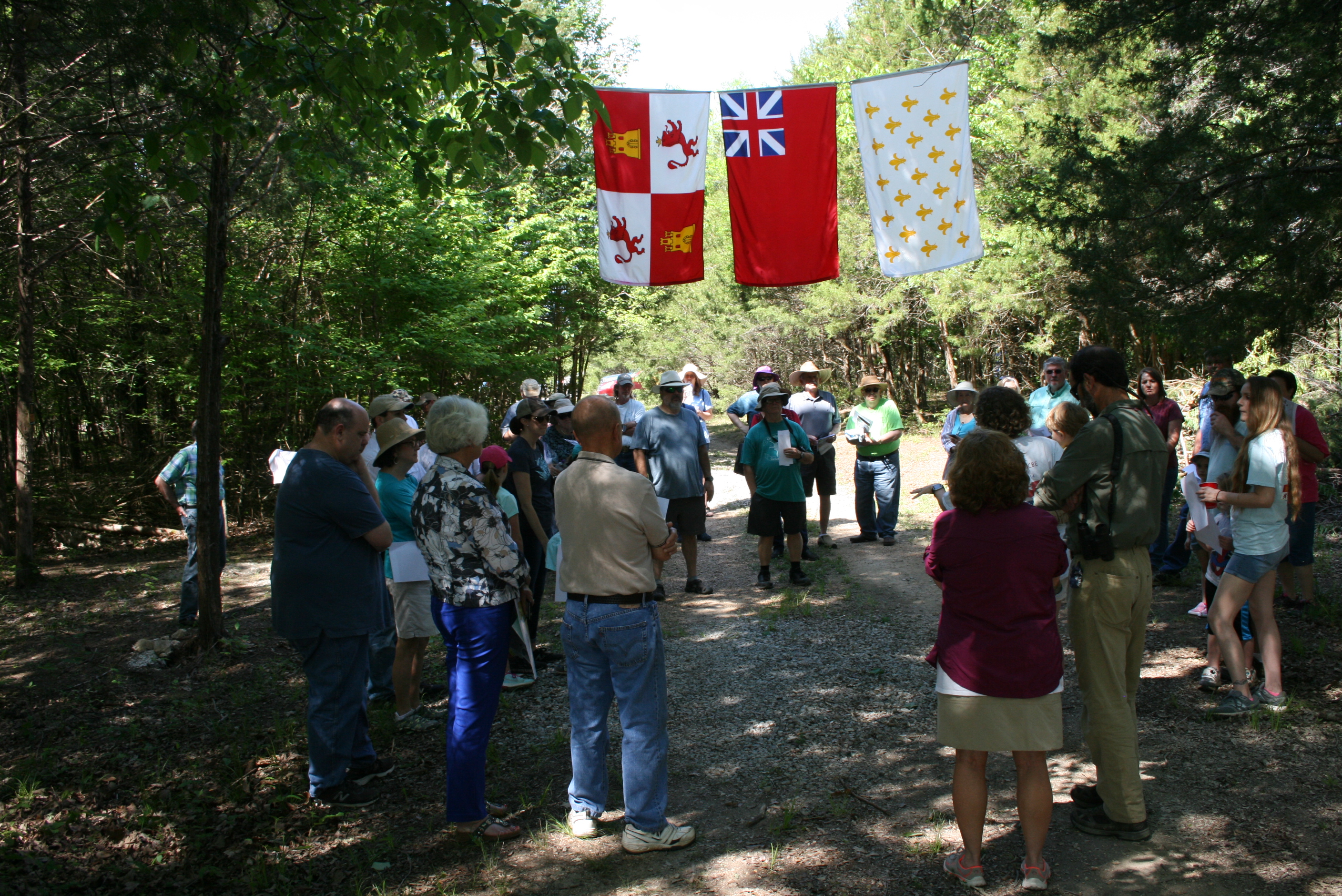
At 10:30 am everyone gathered around
under the flags of the fort, where Dr. Dumas gave a brief talk on the history
of the fort. Then, we walked to each panel, unveiling them one by one and
giving a brief summery of what was on each. (The “Life at a Frontier Fort” and “Native
Americans” panels are not installed yet since we haven’t quite finished the
holes. Everyone seemed to really enjoy the walk and was really interested in
the panels. Again, we cannot thank everyone enough for coming out today. After
we finished the unveiling, we went about the day as normal with digging and allowed
the visitors to help if they liked.
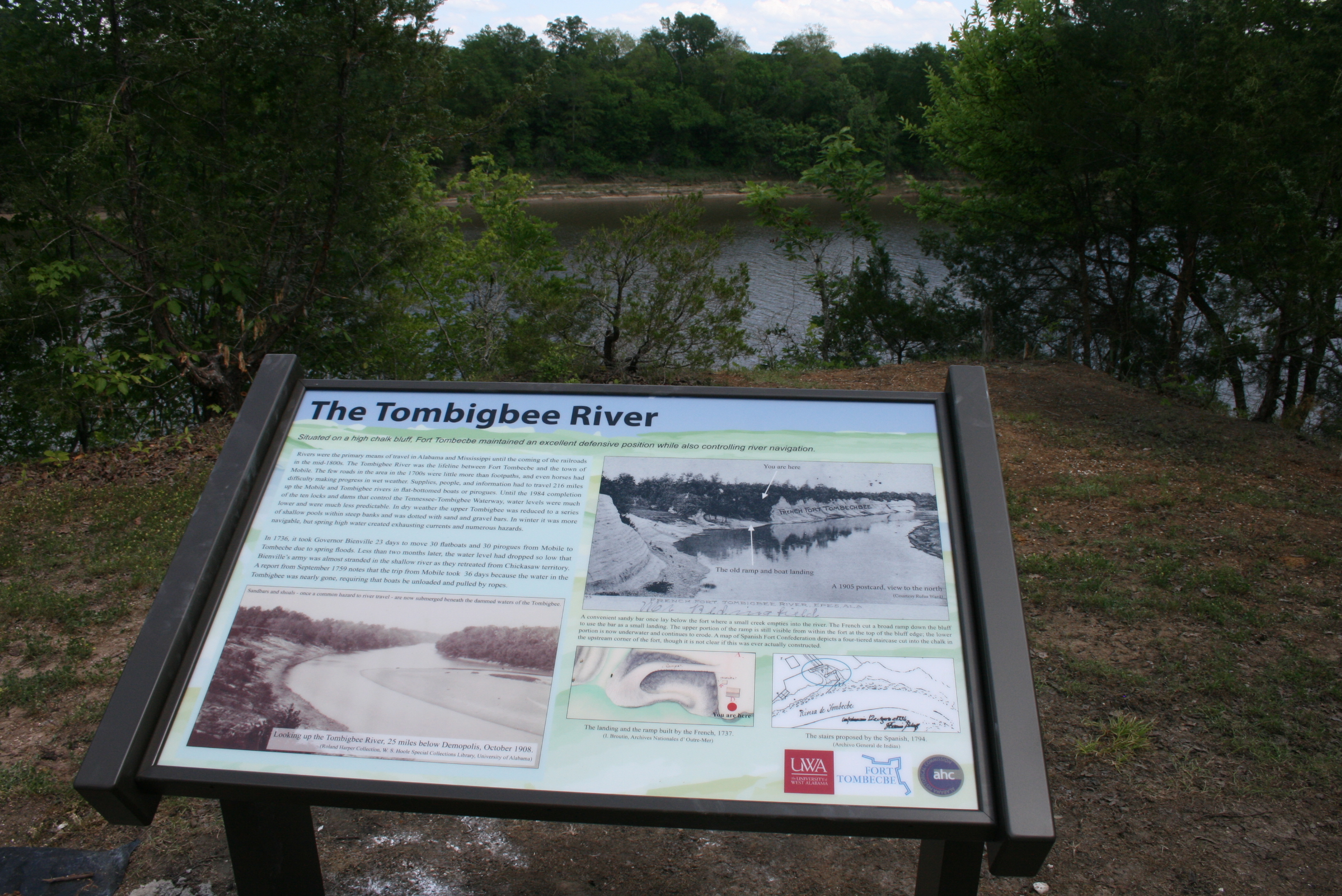
Below, Dr. Dumas unveils the panel about the Tombigbee River, and a close-up of the panel installation nearing completion. 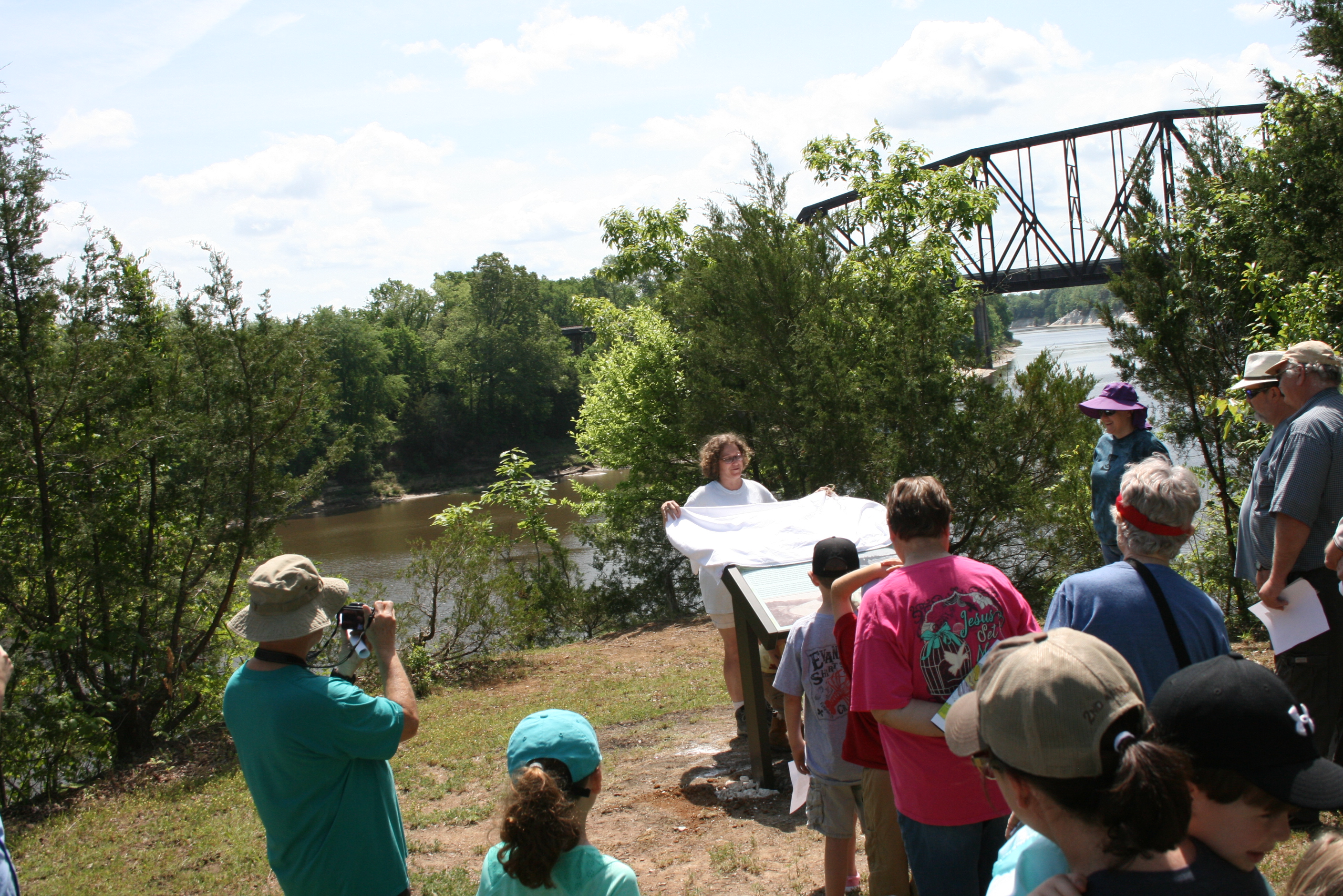
We were able to finish panel hole 14 today
even though, while Natalie was digging, she would have some of the community
come up and ask her questions. She did an amazing job in talking with the kids
and the rest of the community, and letting them help dig and find artifacts. We
screened dirt from panel hole 15. Valencia screened and had many visitors come
over to watch, as well as screen the dirt. They seemed to be very interested in
this. Cory continued digging into panel hole 16, focusing on removing all of
the soil and artifacts from Feature 39, the trash pit. We also opened up four
new holes along the line of where the French palisade used to run. Cedar posts
are placed every 4 meters to outline where the palisade used to be and to help
visitors see how the existing Spanish earthworks covered over the footprint of
the earlier French fort. There are four remaining cedar posts to install, but
we first have to carefully excavated where they will go, making sure that they
don’t destroy any remaining parts of the palisade, such as wood, the builder’s
trench, or any associated artifacts. After opening up the holes, I demonstrated
for volunteers how we went about digging with trowels.
From the bottom of all of our hearts, we
would like to say “Thank you!” to everyone who helped us make this day a
success.