(from left: Valencia Moore, Natalie Mooney, Skyler Browder, Ashley Dumas, Cory Sly, Clementine)
By Ashley Dumas
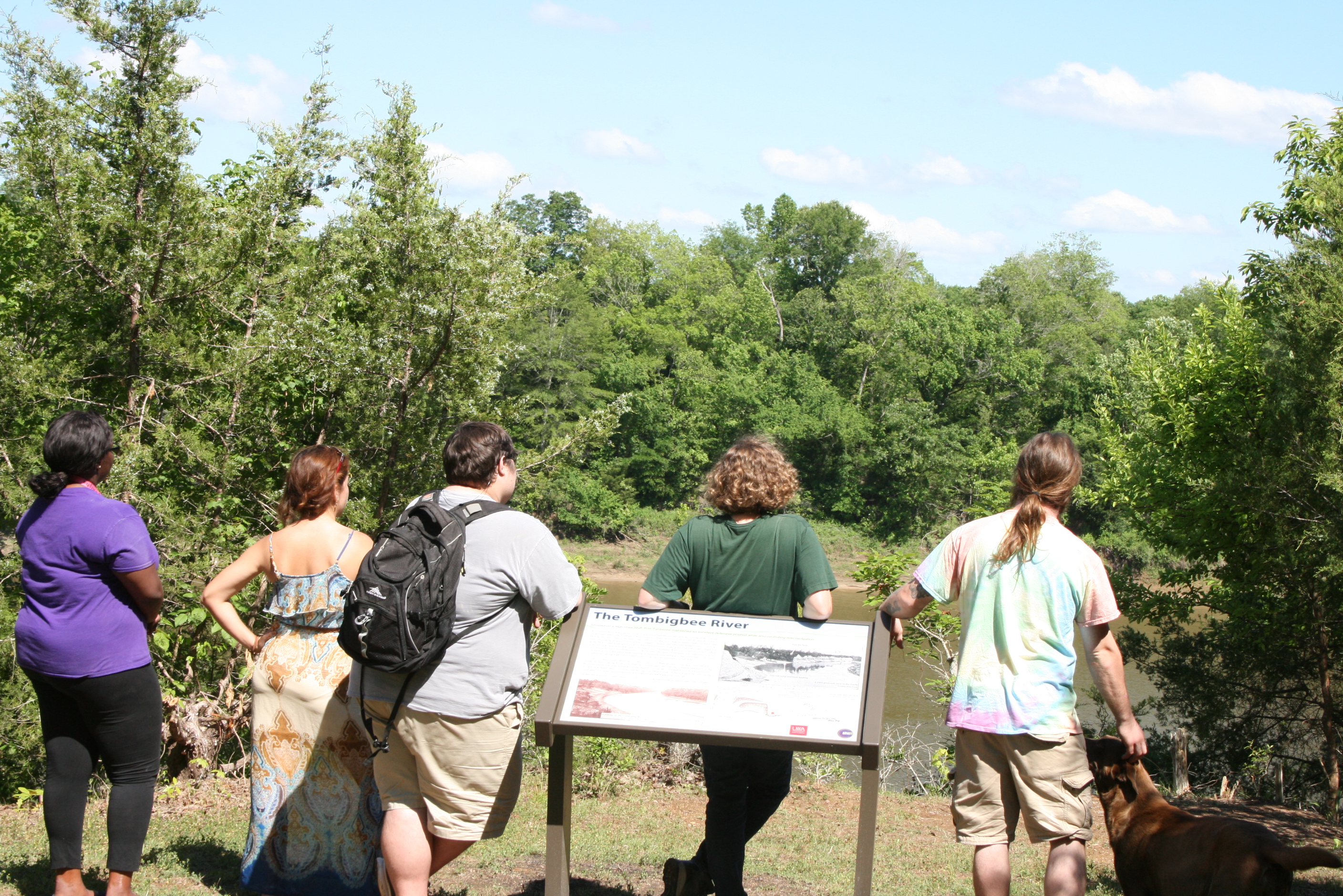
Going into this field school, we knew that our goals would be limited. It has been the first one since 2010 where we dug during the regular school calendar, which means that we can only put in so many hours per week so as not to interfere with the students' other classes. If you've been reading all of the blog posts from this season, then you know we've had a myriad of panel hole #'s swimming in our heads. Generally, archaeological digs will be planned for a specific area of a site where archaeologists suspect there to have been particular activities or buildings in the past. A grid will be laid out over the site and all of the soil and artifacts removed carefully by grid squares. In the case of field school 2017, however, the locations and sizes of our excavation squares were dictated by the best placement for our new interpretive panels. (In the photo above, you can see us proudly flanking the new panel about the Tombigbee River and its importance to the fort.) We used the 1737, 1763, and 1794 maps of the site to predict what we might find in each hole. We were also able to consult the report on the 1980 excavations for some insight into what might await discovery underground. But much of our work this semester has led to completely new and unexpected information, especially regarding the construction of the fort. The map below shows each of the 19 holes that we excavated to prepare for the installation of the panels. Each hole was about 35 cm x 35 cm-- just big enough to be able to see what we were doing and maneuver our tools in the hole, and not too big to be impractical for setting in the legs of each panel.
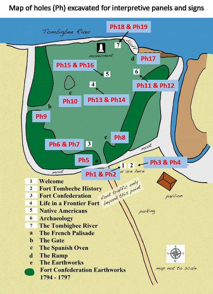
In panel holes 1 through 4, we did not expect to find a lot, because they are situated just outside of where Fort Tombecbe's palisade wall ran and are beyond Fort Confederation's earthworks. In other words, they are outside the walls of both forts and unlikely to have the remains of many past activities. Indeed, there was not much topsoil here and only a few artifacts. Panel hole 5 is at the intersection of the base of the earthworks and the moat, basically in a low spot. Not surprisingly, we dug through nearly a meter (more than 3 feet) of loose, silty soil that had washed into the moat over the years and found nothing.
As detailed in previous blog posts, panel holes 6, 7, and 8 provided the first indication that there is much more to discover about the development of Fort Tombecbe. None of these holes produced many artifacts, but there were a few handfuls of animal bone, a few wrought and early cut nails, recovered from the upper layers. Below this zone of debris, in each hole, was a layer of sticky orange clay mixed with cobbles of chalk. Clay does not occur naturally on these chalk bluffs, so we know that it was dug elsewhere, perhaps in the lowlands across the river or from a nearby stream, and brought to this spot. It was mixed with chalk cobbles and deposited in a layer about 12 inches thick, right on top of chalk bedrock. This pattern of a layer of cultural material on top of a chalk and clay layer (often identified as Layer C in previous posts) was repeated in panel holes 11, 12, 15, 16, 18 and 19. At this time, our hypothesis is still that there were gullies forming in the chalk, causing erosion and mobility issues. We have as much confirmed by the English historical record (see blog post from Week ). Either the French, late in their occupation, or the English began addressing this problem by filling in the gullies and leveling the land with clay and chalk. The trash pit that was found in panel hole 16 has cut nails and a bottle fragment that suggest a late 18th century day, making it likely of Spanish origin. The pit was dug down into the clay, so the clay probably predates the Spanish occupation.
The erosion control apparently was not necessary across the entire site, as panel holes 13, 14, and 17 had thin layers of soil and artifacts deposited directly on top of chalk bedrock. Panel hole 9 was solid orange clay, which we can't explain at this point, but someone was awfully motivated to have brought that much clay up to the bluff.
In addition to uncovering this fascinating insight into the efforts put into maintaining the fort, we also recovered a fair number of artifacts. Initial efforts to sort the materials recovered from the Spanish pit, for instance, are revealing large amounts of trade beads, lead shot, bone, brass hooks (for clothing), nails, animal bones, and broken bottles, which will give us a wonderful little insight into life during the late 18th century. Keep reading the blog to see updates from our laboratory analysis.
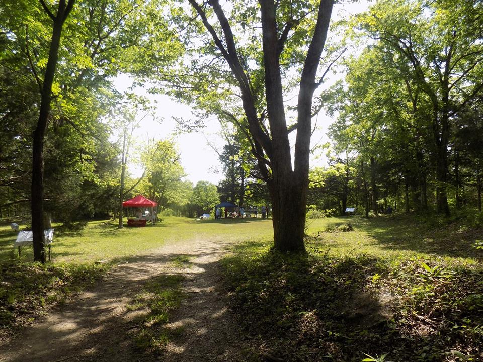
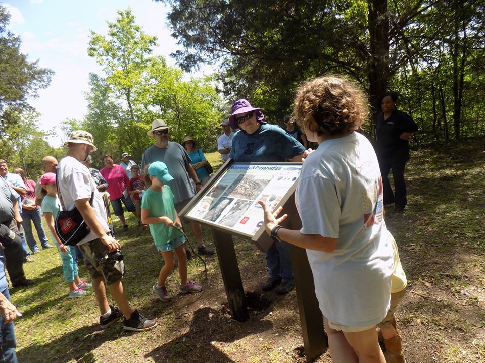
This spring has been important for public interpretation at Fort Tombecbe. Having the interpretive signs finally completed and installed does not make the site any more important than it already is, but I think it helps to legitimize its importance for the public who visit by appointment or just happen to wander in. The completion of the pavilion, loosely styled after some of the smaller buildings that once stood at Fort Tombecbe, makes the site much more visitor-friendly and useful for community groups and UWA students. We hope that the overwhelmingly successful Community Day in April is a sign of a more engaged and aware community, one who appreciates and values the importance of the fort in the history of Sumter County and the state.
Please keep up with the blog over the summer. We'll be posting pictures of our lab work and the things that we find while washing and sorting all of that material that comes in from the dig. As always, thank you for your interest!